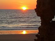
Ngunungurrukun (Coconut Well)
Ngunungurrukun, north of Broome, encompasses a large area including Coconut Well. Judinnang (the ocean reef) and the Lurujarri (coastal dunes) are also adjacent to Ngunungurrukun.
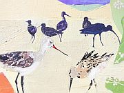
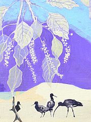
In the tidal area of Ngunungurrukun Gudurlwarany (Brolga) come during the seasons of Wirralburu thru to early Larja to feed, mate and dance.
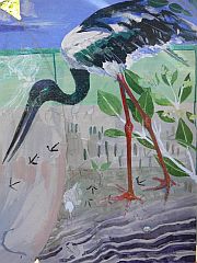
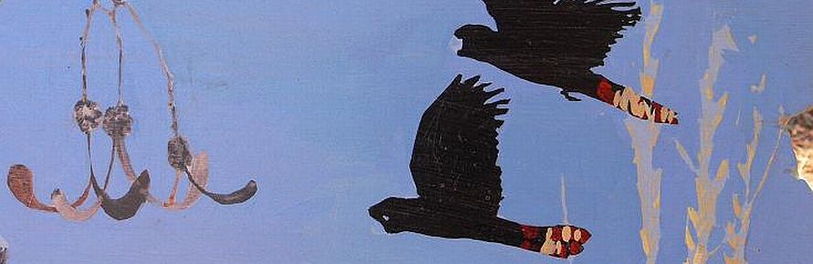
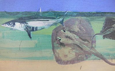
The majestic Lindalinda (Jabiru) can also be seen wading in the estuaries feeding on fish species such as Galbany (mullet) and Walgawalga (salmon) which use the creek to spawn. On the beach you may see wader birds that have flown from northern Europe on their annual migration route. These birds are very shy and will fly off when disturbed.
Wirrkinymirri (Willie Creek)
Although the creek is stunning, this 'living country' is also a dangerous place. The area is prime habitat for saltwater crocodiles. Linygoorr will usually feed on Wangkaja (mangrove crab) and fish, saltwater crocodiles have been known to attack humans.
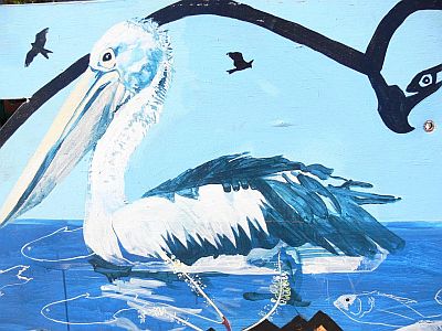
Aboriginal people search here in Biyalbiyal (mangrove) trunks where fat, juicy grubs (witchetty grubs) called Bina can be found. Nimanburr (flying fox) rests during the day and comes out with other nocturnal creatures around sunset. Traditionally people used to wait for them in the paperbark forests and hunt them with sticks. Sea eagles are often seen flying overhead in the search of fish.
The moon and sun dictate tidal movement. With the full moon or new moon come big tides, while waxing and waning moons result in neap tides with less water movement.
The colour of the ocean changes, depending on the season. For instance, during the season of Wirralburu (approximately May) and Barrgana (approximately June - August) cold east winds turn the water to a deep blue. An aqua or turquoise ocean can be seen in warmer times.
Nuwirrar (Barred Creek)
Wirrar is the name of the rock formation that runs from the mouth of Nuwirrir (the inlet) into the bush.
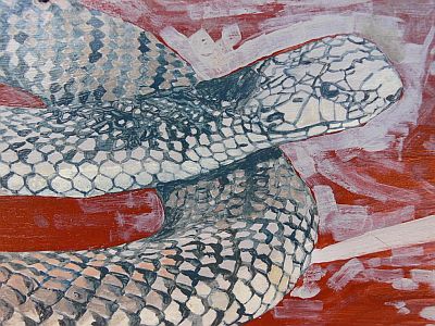
In Bugarregarre a powerful Yunguru (snake) came to life and he lives within the Nuwirrar area protecting the Burru and the people. Yunguru is dangerous to people who are not from this Burru. You are asked to take particular care in this area as there are many Wirril (king brown snakes) living here. These snakes are part of the Burru and you are asked to let them be.
Here Nimanburr (flying foxes) rest during the day in the mangroves and emerge out at sundown to feed on the Garnboor (freshwater paperbark) and Murrga (saltwater paperbark - tea tree) flowers.
There is much Mayi (bushfood) and medicine in this area, such Guwal (snowball bush), Magabala (bush banana) and Gumamu (sandalwood). Some berries are poisonous so please don't eat any Mayi unless a Traditional Aboriginal guide has advised you.
Kardilakan (Quondong Point)
In the Mangal (bush) you'll find Mirda (helicopter tree) which can be easily recognised by its golden or silver trunks. The Mirda is unusual in that is grows new foliage before the rains, indicating that the seasons have changed from Larja (the hot build-up time, approx. October - December) to Mangala (the rainy time, approx. December - March). The mirda timber is not used for firewood as its smoke can make you and others nearby feel ill. The wood is used by Aboriginal people to make Karbinar (shields) and Coolamons.
Walmadan (James Price Point)
Walmadany was a tribal man who lived in this area at the beginning of the 20th century. He was head of his tribal group and was considered to be a powerful Maban man. Walmadany fiercely protected his people, their Jila (living water) and their land against strangers, invading tribes and Europeans. Walmadany's clan clan shared their jila with the Ngumbarl people.
We know that Walmadany and his people's spirits are still living in this area and are looking after Country. Use your "Liyan" (gut feeling) before setting off into this area as Walmadany may want to trick you or the Country may grab you leaving you lost or confused. To avoid trouble do not wander off alone.
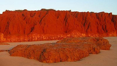
The Yanniyarri (red cliffs) in this area run all the way to Dugal (Flat rock) in the north, before the Lurujarri (coastal dunes) begin again. The word Dugal means red ochre, which can be found in this area. To the south, around Imbalala, you may notice Lardik (fresh water mangrove), Garnboor (freshwater paperbark), and Gunuru (white gum) trees. Also keep an eye out for the heart shaped vine known as Wilga. Wilga is a traditional medicine, whose fibres can be beaten and wrapped around the head for headaches and body for bone aches. If you're lucky you might see a dugong or green turtle in the nearby ocean feeding on seagrass in this area.
Minarriny (Coulomb Point)
In the Manarriny area it is safest to stick to the coast as there are many taboo areas including Aboriginal burial sites.
In the Mangal (bush) along the freshwater creek you may see tiny purple and pink flowers on the sundew plants. These plants are carnivorous with their sticky stems designed to trap insects.
The Barragool (Red Gubbinge tree) provides Mayi (bush food) in the season of Mangala (the rain time - approx. December - March).
In the season of Barrgana (the cold and dry southeast wind time, approx. June - August) the Jarridiny (Hakea tree) flowers. The Djaridin (Hakea) flower contains honey that is good to drink when steeped in water.